Babylon Road
The Babylon Road serves as an equestrian and motorized trail throughout its length within the Red Cliffs Desert Reserve and as primary access to 7 trailheads and 13 designated trails. The road consists of a narrow dirt road maintained by the County and is subject to drifting blow sand which can be troublesome for 2WD passenger vehicles. About ½ mile into the area after crossing the north boundary fence, visitors reach the Toquerville Mine trailhead which serves primarily as a trailhead and parking and unloading area for equestrians and motorized recreationists. Another half mile into the area brings visitors to the Sand Cove trailhead which provides vehicle parking for visitors to the primitive Sand Cove recreation site (especially those with 2WD and low-clearance vehicles) and hikers choosing to use the Flicker, Arch, Sandstone Mountain, Sidewinder, Red Tail, and Raven trails. A rough jeep road is available from the trailhead to directly access the Sand Cove site, but 4WD and high-clearance vehicles are strongly recommended for this option. For safety reasons, vehicles pulling trailers of any kind are not recommended to proceed beyond the Sand Cove trailhead. The Babylon Road past this point becomes increasingly narrow and includes steep, winding grades on a clay base which becomes treacherous during and after rain. Portions are also very rocky with protruding bedrock and occasional washouts from heavy rains. Steep drop-offs on the west side of the road will be unnerving to some passengers. At the foot of the first major elevation drop, visitors will reach the Mineshaft trailhead (limited parking) which serves the Mineshaft trail with links to the Historic Babylon, Little Purgatory and East Reef trails. Further to the south, and below the steepest decline on the road, visitors will reach the Historic Babylon trailhead at the Gap with links to the Little Purgatory, East Reef, and Mineshaft trails. Further down is found the East Reef trailhead (limited parking) with a direct link to the East Reef and Historic Babylon trails. Finally, visitors may continue to the end of the road, some 3¼ miles from its start at the north boundary of the Reserve, and stop at the Babylon Mill Site with direct access to the Virgin River and the Virgin River trail. Total elevation loss top to bottom is about 520 feet. All but the southern tip of the road lies on public lands administered by the BLM within the Red Cliffs NCA. A small portion of the southern end touches on land owned by the Virgin River Land Preservation Association.
-
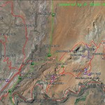
- The Babylon Area Map shows the relationship of the Virgin River trail with all other trails in the Babylon complex.
-
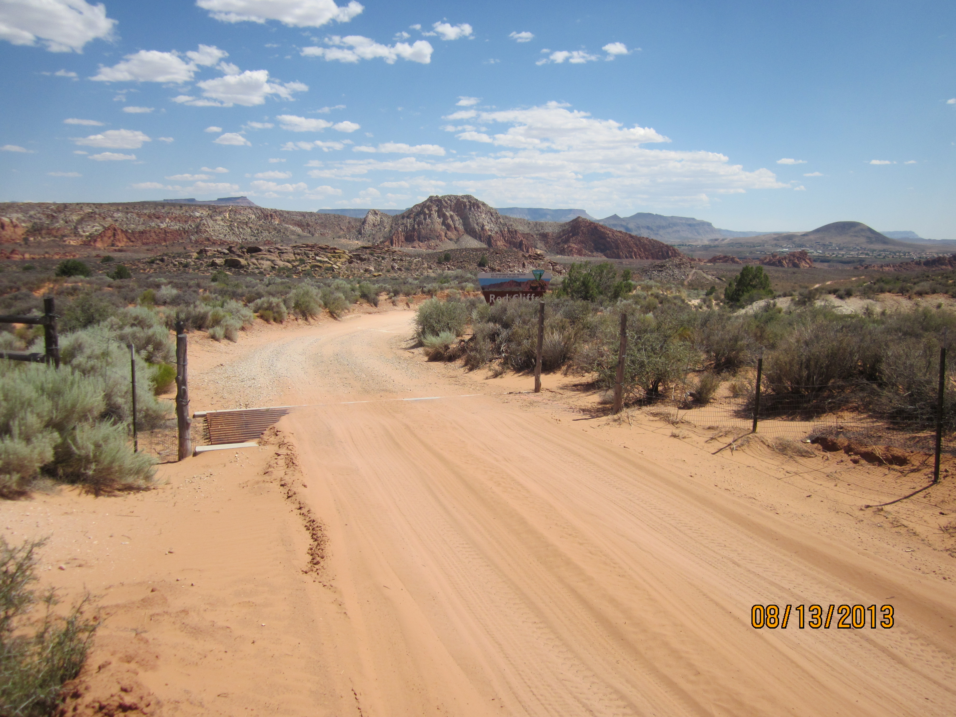
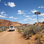
- The road intersects the north boundary of the Red Cliffs Desert Reserve/NCA at this signed location and continues for 3 1/2 miles to its southern end at the Virgin River.
-
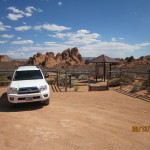
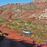
- The Toquerville Mine trailhead is the first parking area reached and serves as an unloading area for equestrians and motorized vehicles.
-
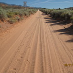
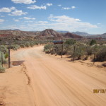
- Portions of the road consist of long stretches of blow sand which can be troublesome for 2-wheel drive sedans.
-
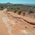
- Other portions of the road can be very rutty especially after rains and require a high-clearance vehicle to safely navigate.
-
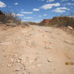
- Some stretches of road are very rocky and rough on passenger sedans.
-
- About one mile south of the entry point visitors will reach the turnoff to Sand Cove, a popular primitive recreation site.
-
- Visitors may park their vehicles at the Sand Cove parking area to hike into the primitive recreation site or to access the Flicker and Sandstone Mountain trails. 4-wheel drive vehicles can continue 1/2 mile over a jeep road to get to the recreation site.
-
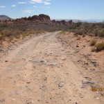
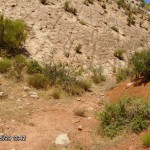
- This section of rocky road above the Mineshaft trailhead is rough to the point of needing a high clearance vehicle to safely get through.
-
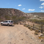
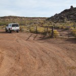
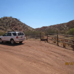
- At the foot of the first major decline, visitors will reach the Mineshaft trailhead that has links to the Mineshaft and Historic Babylon trails.
-
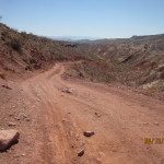
- The road continues down a windy, narrow section that can be slippery and dangerous during and after rains.
-
- At the foot of the second major decline, visitors will reach the Historic Babylon trailhead with direct links to the Historic Babylon, Little Purgatory, and East Reef trails.
-
- From the Historic Babylon trailhead, visitors can follow user trails that lead to dinosaur tracks in the sandstone sediments.
-
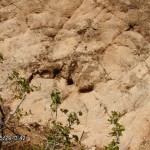
- The dinosaur tracks pictured here are scattered across portions of rocky sediments on both sides of the Gap at the Historic Babylon trailhead.
-
- About 3 miles south of the entry point, visitors will reach the East Reef trailhead that serves as access to the East Reef trail and a connection to the Historic Babylon trail.
-
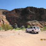
- Babylon Road ends 3 1/2 miles south of the entry point at this sandy location above the Virgin River.
-
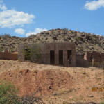
- At this southern most location, visitors will observe an old historic mill site and a failed attempt to construct a more contemporary feature while the site was in private ownership.
-
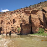
- Visitors can access the Virgin River for play or for hiking the 4 1/2 mile (unsigned) Virgin River trail that proceeds to the east.