Church Rocks

This trail is a popular slickrock, biking trail and is a nice, scenic trail for hikers as well. Access exists to the trail via a culvert under I-15 but has no legal standing and involves private property just south of the City of Washington’s large water tank. Another I-15 underpass is available from a community trail starting in the Sienna Hills development on the south side of the highway that connects directly into the Grapevine trail. For many users, the trail is best reached from the Grapevine trailhead via the Grapevine and Prospector trails, a distance of about 1.5 miles from the trailhead to the wash where the Church Rocks loop trail begins, or from the Cottonwood trailhead via the Prospector trail, a distance of about 5 miles from the trailhead to the intersection with the loop.
The Church Rocks loop is a moderately difficult, mostly slick-rock trail, about 2.6 miles in length with an elevation gain of about 185 feet from the wash to the highest point on the ridge, and a total up and down elevation change of about 750 feet. To do the loop trail from the Grapevine trailhead, follow the Grapevine trail to its intersection with the Prospector trail and follow Prospector to one of its two intersections with the Church Rocks loop. You may take the short connector trail to the Church Rocks loop that climbs to the upper section of the trail or take the Prospector trail east to the lower Church Rocks trail. There are several “illegal” trails in the area of the first part of the Prospector trail that can cause some confusion, but trail signs and cairns should keep you on the correct trail. The mostly slick-rock trail may not be inviting to some equestrians because of the hard substrate and some steep climbs on the red rock. The highlights of the hike/ride are the views of the beautiful Church Rocks formations just beyond of the eastern end of the trail and many unique, red rock formations along the way. The trail lies entirely on lands administered by SITLA.
-
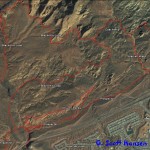
- This area map shows the Church Rocks trail in relationship to all other trails in this part of the Reserve/NCA.
-
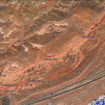
- Church Rocks trail map
-
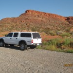
- Vehicles park at a graveled pull-over at the mouth of the Grapevine Trail Head access. This is reached on the North side of I-15, Exit 13
-
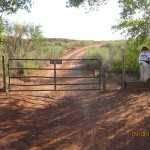
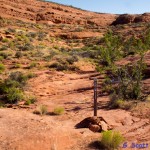
- Stepover Gate to Grapevine Trail
-
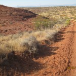
- Grapevine users leave Grapevine 2-track for popular, single track, Prospector trail.
-
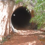
- Tunnel under I-15 is a popular access for bikers leading directly to Church Rocks trail.
-
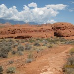
- There are several red rock formations along Prospector trail which provide a delightful background for visitors.
-
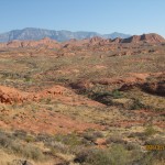
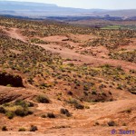
- Red rock formations and the Pine Valley Mountains are seen from this point on Prospector trail.
-

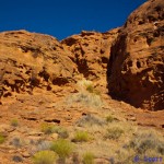
- Much of Church Rocks trail runs through and adjacent to numerous, spectacular slick rock formations.
-
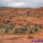
- Slick rock provides excellent biking for adventurous users.
-
- View of red rock formations above the lower trail.
-
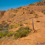
- Well marked trail leads hikers and bikers up winding slick rock segment.
-
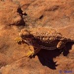
- Observant visitors will find opportunities to enjoy lots of desert critters like this horned lizard.
-
- The lower Church Rocks trail seen from the upper trail loop.
-
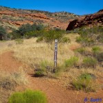
- Church Rocks trail joins Prospector trail at this point.
-
- Prospector trail joins Church Rocks at the 2nd location further to the West.
-

- View of the spectacular Church Rocks formation from the East end of the loop.