Coachwhip
This short 0.4 mile trail serves as a connector trail between the Spanish Wash and Bracken’s Loop trails. Formerly, it was considered the western segment of the Cottonwood Hills trail but was renamed by BLM to make it clear it was not directly connected to Cottonwood Hills. The trail is a single track throughout its length and is suitable for hiking and equestrian use but is difficult for biking due to its often deep, sandy nature and steep gradient. East to west elevation gain is about 190 feet, most of it on its western end. The trail provides opportunities for hikers and equestrians to form a variety of loops with Bracken’s Loop, Spanish Wash, Prospector, Grapevine, and Cottonwood Hills trails. Nice views into the Cottonwood Canyon wilderness area are had from the trail’s higher elevations. The trail lies entirely on lands administered by the Bureau of Land Management in the Red Cliffs NCA.
-
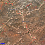
- Coachwhip trail map showing its linkages with Spanish Wash and Brackens Loop trails.
-
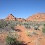
- The trail starts at its west end from the Brackens Loop trail and remains level at a higher elevation for the first 1/4 mile.
-
- Through much of its length, the trail consists of deep sand which is trying for hikers and bikers but very popular with equestrians.
-
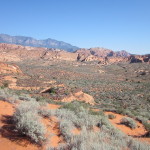
- Pretty views of distant formations are seen from this high spot which then drops off nearly 200 feet to the drainage below.
-
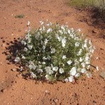
- During wet seasons, visitors may see lots of floral displays along most of the trail.
-
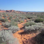
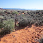
- In the lower drainage, the trail winds through sage brush flats.
-

- At this point the trail joins the Spanish Wash trail at the latter’s north end.