Gunsight
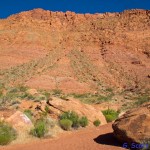
The Gunsight Route is a rugged, steep, 1.3 mile hike and climb that begins at the Gunsight trailhead off Tuacahn Drive in Ivins, Utah. The trail climbs about 1,500 feet to the Gunsight Pass. Currently there are no Gunsight route signs. Most of the trail is not marked except at the very bottom and at the top. The route is extremely strenuous and is suitable only for persons in good physical condition and who are not terrified of heights. Proper clothing, lots of water, and good maps (or a knowledgeable guide) are a must. From the trailhead, proceed west about 1/2 mile on the Toe Trail and turn right up the main wash going north towards the head of the canyon. From there follow the wash about 1/3 mile and look for a faint trail behind a rock on the left and a small trail marker about 10 yards out of the wash. (If you reach a huge boulder lying over and across the entire wash, you have gone about 120 yards too far and need to back up). From this point, the trail climbs up a steep ridge and over to the major drainage on the left. The drainage is steep, very rocky, and subject to falling rocks. The drainage leads hikers to the bottom of a solid cliff face near the top of the mountain. Closely follow the cliff face up and to the right to reach the notch for which the Gunsight Route is named. Most of the route lies in the Red Mountain Wilderness Area. Bikes and motorized vehicles are prohibited. The trail is unsuitable for equestrian use due to extreme steepness and loose, rocky footing.
Views from the top of the trail are spectacular and breathtaking. The route offers an option for coming down the face of the mountain for hikers taking the complete Red Mountain hike beginning at the Red Mountain trailhead off Highway 18 north of Snow Canyon State Park. A strenuous loop hike up the Red Mountain Trail from the Ivins trailhead and down the Gunsight Route returning to the Ivins or Gunsight trailheads via the Toe Trail (or vise-versa) is also possible. Lands inside the wilderness area are administered by the BLM within the Red Cliffs National Conservation Area. Adjacent lands are administered by the Utah Division of Parks and Recreation.
-
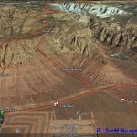
- Gunsight Map
-

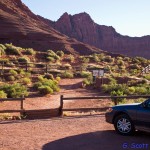
- Gunsight trailhead on Tuacahn Drive.
-
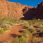
- From the trailhead the Toe Trail is used to access the Gunsight route.
-
- About 1/2 mile west of the step-over hikers drop off to the right to enter the main wash heading north into the canyon.
-
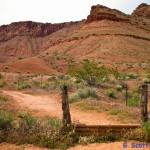
- A faint trail breaks off to the left and leads hikers to the access ridge.
-
- If hikers reach this giant boulder laying across the main wash they have passed the wash exit point by 120 yards.
-

- A small wooden trail marker lets you know you’re on the right path. Follow it up the ridge face.
-
- At this point on the ridge face the faint path gets very steep. You will soon cross over to the left to enter the drainage that leads to the cliff face.
-
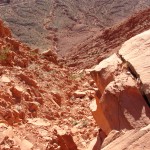
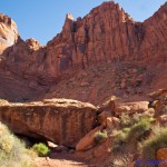
- A steep, rocky drainage takes you to the cliff face below the Gunsight notch.
-
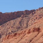
- The notch for which the Gunsight trail route is named is seen in the upper right corner.
-
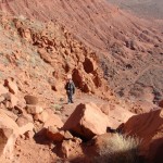
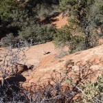
- Part way up or down in the drainage you can stop to rest or take photos of the spectacular scenery.
-

- The drainage takes you to this cliff face which leads you to the notch further up to the right.
-
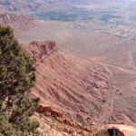
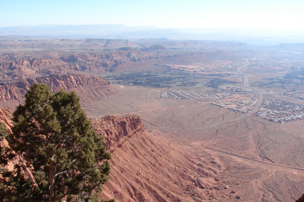
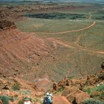
- Breathtaking views of Washington County and Arizona from the notch.
-
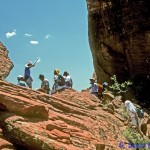
- Group of hikers resting in the Gunsight notch.
-
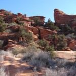
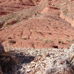
- Once on top the landscape consists of myriad red sandstone formations and sandy soils with pinyon-juniper stands and a variety of desert vegetation.
-
- A small trail marker lies behind the notch on top of the mountain to assist hikers in finding the return point. No clearly marked trails exist on this part of the mountain.
-
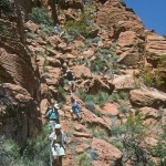
- Hikers going down the route by the cliff face
-
- Hikers making their way down the steep drainage to the bottom of the mountain.
-
- The Ivins trailhead provides an alternate ending or starting place for Gunsight hikers.