Welcome to the Red Cliffs Desert Reserve
Federal Agencies Reconsidering Reserve Expansion
Although the public comment window is closed, the Bureau of Land Management (BLM) is considering reinstating protections for the Moe’s Valley area, known as Zone 6, and reassessing approval of the Northern Corridor Parkway. Additional information is available at the BLM National Environmental Policy Act Register. Learn more & read our FAQ’s HERE!
Read this article from the Salt Lake Tribune, November 10, 2025.
 Visitor Center
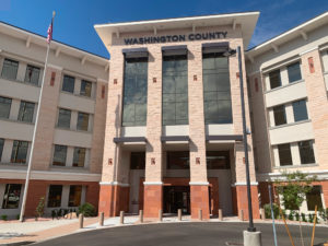
For many, the free visitor center of the Red Cliffs Desert Reserve is a treasured place to learn about local wildlife, plants, and ecosystems while explaining the purpose of the Washington County Habitat Conservation Plan (HCP). The visitor center has live animals and interactive exhibits with staff members available to give presentations to small groups by appointment. Visitors are welcome to drop in during business hours from 8 a.m.–5 p.m., Monday–Friday.
The Red Cliffs Desert Reserve is considered a very successful HCP. It is administered by Washington County in coordination with the Bureau of Land Management (BLM), United States Fish and Wildlife Service (FWS), Utah Department of Natural Resources (DNR), and State of Utah School and Institutional Trust Lands Administration (SITLA). This collaborative partnership has the primary goal of recovering the threatened desert tortoise while carefully managing recreational activities and utility projects to benefit future generations in an extraordinarily unique environment.
Experience Diverse Ecosystems
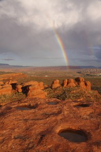
When you enter by one of the Reserve’s distinctive “step-over” gates, you are accessing a special place: a place that is a privilege to visit. Not just another hiking trail or bike route, you are entering a wildlife reserve spanning almost 69,000 acres. Set aside to protect the Mojave Desert tortoise and other rare plants and animals, the reserve sits at the merging of three great ecosystems: the Mojave Desert, the Great Basin, and the Colorado Plateau.
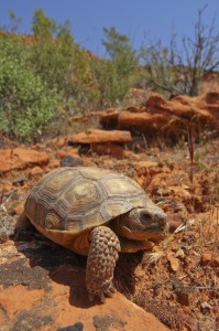
The Reserve is biologically rich with a unique array of animals and plants. It is home to the most northern populations of the desert tortoise, Gila monster, sidewinder rattlesnake, and chuckwalla — reptiles typically associated with hotter and more southerly deserts like the Mojave. A significant portion of the shrubs in this area, such as blackbrush, are more commonly found in the cooler Great Basin Desert. The conditions in the region are such that several endemic species (those which occur no where else in the world) are found here.
Protect A Functional Expanse
The Reserve was established in 1996 to protect a large, diverse, and functional expanse of habitat capable of sustaining wildlife populations threatened by rapid development and habitat loss. Located immediately adjacent to several growing communities in southwestern Utah, the Reserve also protects the cities’ scenic red rock backdrop and an increasingly popular area for recreation.
The majority of the Reserve spans across the north-central portion of Washington County, with a recent addition of almost 7,000 acres in a new zone located southwest of St. George near the community of Bloomington. It is approximately 20 miles wide and 6 miles deep. The Reserve is north of Ivins, Santa Clara, St. George and Washington City, south of Leeds, and west of Hurricane and LaVerkin. The Reserve is trisected by Highway 18 in the west and I-15 in the east. There are many access points and trails for recreational opportunities within the Reserve.
Click here to see upcoming events on our calendar


