Raven
Access to the Raven trail can be made out of the Sand Cove trailhead parking area and taking the Sandstone Mountain trail from its western end to the saddle on the top of the mountain. Visitors then pick up the Red Tail trail heading northeast and join the Raven trail about 1/3 mile east of the junction with the Sandstone Mountain trail. The trail continues 0.9 miles to the south to rejoin the Red Tail trail near the latter’s southern terminus. Moderate to easy in difficulty, the trail is mostly sandy with some rocky sections and drops about 290 feet from its north end to its southern end. Consisting of an old jeep road, the trail is most often used by equestrians and ATV riders as part of an extended loop system that connects with the Sandstone Mountain trail and trails that cross private and state lands to the east heading into the communities of Toquerville and LaVerkin. The trail is currently open to motorized travel. Views to the east and south include the Hurricane Cliffs, portions of Zion National Park, Gooseberry Mesa, and parts of the Hurricane Valley. The trail runs across land administered partly by the Utah School and Institutional Lands Trust Administration (SITLA) and partly by the Bureau of Land Management within the Red Cliffs NCA.
-
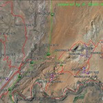
- The Babylon Area Map shows the relationship of the Virgin River trail with all other trails in the Babylon complex.
-
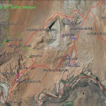
- The Sandstone Area map shows the Sand Cove access trail and all linkages to adjoining trails in the Sandstone Mountain complex.
-
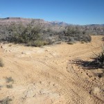
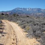
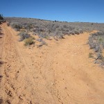
- The Raven trail starts at its north end at this junction with the Red Tail trail which breaks off to the right.
-
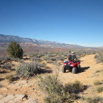
- The Raven trail is popular with ATV riders and has connections to Toquerville, LaVerkin and even Leeds, Utah.
-
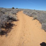
- Portions of the upper trail are quite sandy but have nice views of the Pine Valley Mountains to the west.
-
- When wet, portions of the trail can be very muddy and difficult for all kinds of travelers.
-
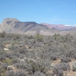
- Views to the north from the upper section include this view of LaVerkin Black Ridge, the Kolob peaks and snow capped Cedar Mountain.
-
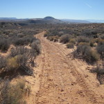
- The middle portion of the trail drops off to the south and descends through sandy portions through sage brush flats.
-
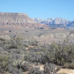
- Views to the south include Hurricane Mesa and Zion National Park.
-
- The trail ends at this southern junction with the Red Tail trail about one mile from its start.