Red Reef East
The Red Reef East trail can be accessed from either of 2 step-overs in the Red Cliffs campground, the Red Reef East trailhead or the Anasazi trailhead via a connector trail. The trail, an old 2-track access road, is about 1 mile long to the north boundary of the Red Cliffs Desert Reserve/NCA with an elevation gain of about 100 feet and an up and down elevation change of about 150 feet. The road past the boundary fence continues north-east toward Leeds. The route is generally easy and offers excellent views of the red sandstone cliffs and mountains to the north and west. It is open to hikers, bikers, and equestrians and lies entirely within lands managed by the Bureau of Land Management in the Red Cliffs NCA.
-
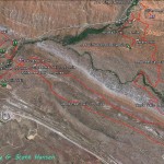
- Red Cliffs area map shows the Red Reef East trail in conjunction with all other trails in the extended area.
-
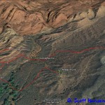
- This map shows the Red Reef East trail and its key linkages.
-
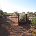
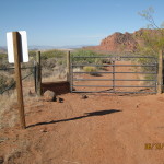
- Primary access to the trail starts at this gate and stepover from the Red Cliffs Campground.
-
- The trail consists of an old road bed with a dirt substrate and is moderately level throughout its length.
-
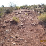
- A few portions of the trail involve rocky inclines.
-
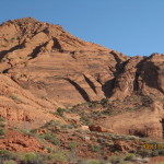
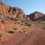
- Views from the trail include spectacular red cliffs which are part of the Cottonwood Canyon Wilderness area.
-
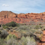
- Other views include this panorama of the red cliffs span across the west horizon. Click on the picture for a panoramic view.
-
- The trail ends at this stepover at the boundary of public lands and private lands to the north.